Top 10 Bozeman Bike Trails
Steve McGann | Saturday Jun. 1st, 2024
We have been riding our bikes in Bozeman for many years, for pleasure and exercise, errands and commuting. The growth of our city has made this both harder and easier. It is harder, of course, because of much more traffic. I never did ride on Main Street, but rode across town on Babcock. Some years ago I moved out to Olive, and lately I use Story. It is a matter of being safe and adaptable. Yet riding around our town is, at the same time, more enjoyable because over the years the city and especially the Gallatin Valley Land Trust (GLVT) have created many miles of bike lanes and urban trails. Here is a list of the trails that have become favorites for me.
Trail to the M
This is a relatively new addition to the bike/hike trail system and, to me, it’s about the best one yet. The trail begins at the intersection of Story Mill Road and Bridger Drive and runs two miles to the M parking lot. It is paved all the way and provides a good workout up, and a great coast down. After the first mile, the trail crosses Bridger Drive to the mountain side at a controlled crossing. A modern bridge crosses Bridger Creek just above Lyman Creek. From there, things get steep and the views get expansive. For a hardcore workout, park your bike at the top, avoiding the parking crush at the M, and go for a hike before flying back to town on the downhill.
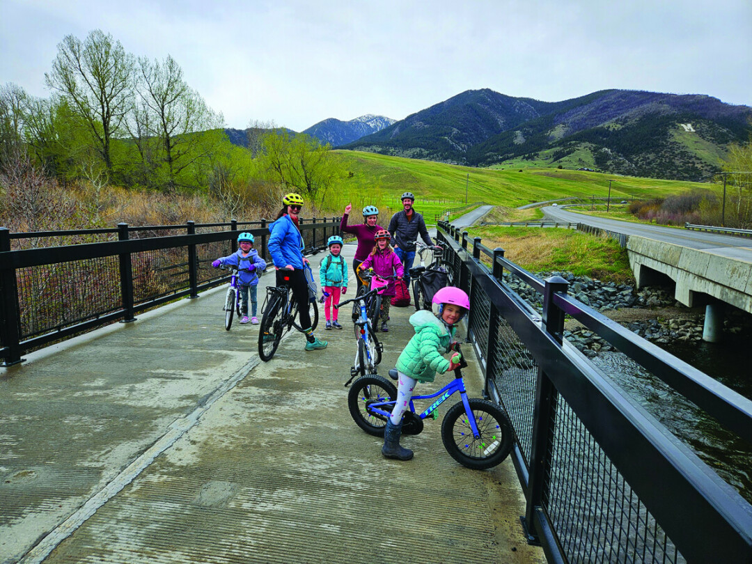
Story Mill Spur
This trail ends where the M Trail begins, and provides a route to downtown. Ride along Story Mill Road or through the nature trail in the Park. Parts of this trail follow old railroad tracks, and also meander along Bozeman Creek as it flows to the East Gallatin River.
A side trip takes you into Story Mill Park and through the nature area, where birds (and sometimes other critters) can be observed. Pull over for a break at a convenient bench and contemplate the waving grass. This is a pocket of wildness inside the city limits.
Gallagator Trail
A bit of route-finding on city streets around the Library takes a bicyclist from the Story Mill route to the Gallagator. This trail begins just south of the library complex on South Church. It runs south, ending near Kagy after crossing the creek several times on sturdy bridges. One of the most popular routes in town, it is a jogging, dog walking, stroller pushing trail, so be courteous, slow, and careful when biking. This is a good connector from the northeast side of town to MSU.
Sourdough Trail
The Sourdough Trail begins just off Fairway Drive south of Kagy continuing south, past Valley View golf course and through the woods behind several subdivisions. It meanders all the way to Goldenstein at Tuckerman Park. A road ride down South Third and east on Nash connects to the Sourdough Canyon / Bozeman Creek road and trailhead. This road is five miles to the creek bridge and another five to Mystic Lake. It is thus possible to link trails from the M to Mystic Lake, from one mountain range to another. The 10 miles of the Canyon road are definitely not for cruisers or road bikes, but neither are they single track mountain bike trails. The entire route from the M to Mystic lake would cover over 25 miles of fun.
Burke Park
This trail extends from Lindley Park to Kagy on the Burke Park ridge. Both ends are rugged, but the stretch on top is wide, and the view of the mountains and the town is dramatic. If the steep sections seem daunting, there are a couple other access points from the hospital, and from Hillcrest Senior Living. This is not so much a cruising ride as it is a scenic route. It is fun to take a break on a convenient bench and gaze at the southern aspect of the Bridgers, or pick out buildings and neighborhoods in Bozeman which lie just at the foot of the hill.
Highland
This is another route that begins at Lindley and ends at Kagy, parallel to the Burke Park trail, but farther east, and paved. The asphalt makes it smooth, but not easy. It is quite a hill to climb behind the hospital and up around Hillcrest. Of course, that effort expended always makes for a fun coast down after the turnaround. Across the road is Highland Glen; while it’s mostly a singletrack mountain bike route, it is possible to stay high if you don’t ride down into the little canyon, and spin around on the crest.
Babcock
From the intersection with West Main out to its end at the Norton Ranch subdivision, Babcock has good, wide bike lanes on both sides of the street. The traffic dissipates as the ride heads west. After Cottonwood it is mostly clear. From the end of Babcock, about four miles from Main, it is possible to find trails through parks in the Valley Lakes development, both around the lakes and on to Oak street and Gallatin Regional Park, even all the way north to trails behind Costco to Cattail Lake. Rides from 10 to 20 miles are possible from midtown on a series of bike lanes and good trails with low traffic stress.
MSU
The neighborhood streets between Main and bike lanes but, other than 11th and Wilson, are not busy with traffic. Meandering around these shady streets is relaxing. There is a paved trail on College from West Main to 11th. Throughout campus, there are many walks and lanes that are great for rides when the University is not in session. There are also trails south of campus, past the Museum of the Rockies, that hook up with other routes in subdivisions around Goldenstein. It is fun to set out and explore the south end of Bozeman.
East Gallatin/Glen Lake
Trails begin in the subdivision behind Bridger Drive along the creek, wind through the streets near Bridger Creek Golf Course and approach Glen Lake from the east. Several loop trails run through and around the park. From there, it is possible to ride all the way to Cherry River on the frontage road. Compared to some of the other routes listed here, this series of trails is not much used or at all crowded. If a solitary ride in the woods is your objective, this may be the place. It can be linked to a ride on the M Trail for a longer route to and from town.
Headwaters/Three Forks
This last trail is neither close to Bozeman nor does it have access from town. It requires hauling bikes to the other end of the valley. But it is a great trail and one that is normally rideable for an extra month on either side of snow season. The trail begins in the Missouri Headwaters State Park and heads on to the town of Three Forks, crossing the Madison River, passing under Interstate 90, and running along the ponds outside of town. In town, it is a pleasant meander to find the trail that runs along the highway out to the Drouillard fishing access on the Jefferson at US 287. The entire route is around seven miles, so a round trip would be fourteen, with a stop in town for coffee or lunch.
This has been an overview of trails we have enjoyed in and around Bozeman. There are plenty of others—many routes and bike lanes to explore. Most of the trails described here are either paved or hard pack gravel and dirt. A couple are on the edge of mountain bike paths. But I will let others more daring describe the wide variety of singletrack routes available in our area. The optimum bike for the trails covered here is probably a gravel bike or a less technical hardtail mountain bike.
The best and safest way to access these trails is to load the bikes in the truck or on the rack and drive to the trailhead parking lots. However, if you want to ride to your ride, be careful of your route. Use bike lanes whenever possible, ride on streets with light traffic, and obey all signs and lights. Be consistent, do not act like a vehicle in some situations and a pedestrian in others. Most motorists will be courteous of bicyclists if they are aware and sensible in return. Wear a helmet and neon colored clothing. Keep your bike in good condition—riding is much more pleasant with well-tuned equipment.
Bozeman is a bike-friendly town, though that does not mean that all motorists know about it. Driving a vehicle should engage all of a person’s attention. Riding a bicycle requires even more vigilance. Be safe, and have fun!
| Tweet |