What's Your Beef?: Naming a Familiar Peak
Monday May. 1st, 2023

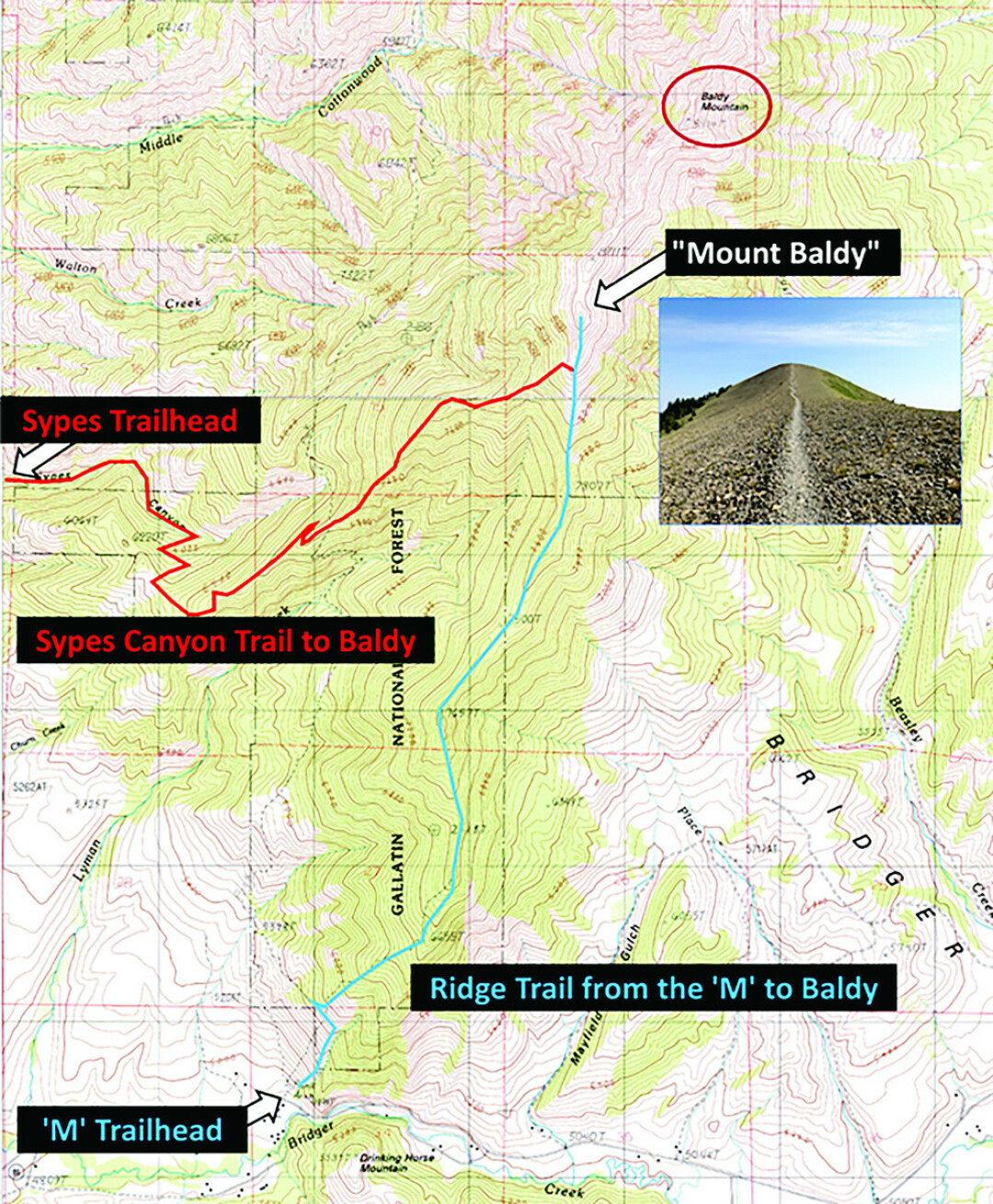
Many locals are familiar with this view. After traversing 4 miles and ascending almost 4000’ from the College ‘M’ trailhead, hikers and runners reach this final ascent to the summit of… an unnamed bald peak at the southern end of the Bridger Range. USGS and U.S. Forest Service topographic maps have no name associated with this summit, although locals know it as “Mount Baldy.” Local runners participate in “The Baldy Blitz,” which is a run from the ‘M’ up to Mount Baldy. The “Baldy Aid Station” of the Bridger Ridge Run is situated on the bald summit of Mount Baldy. Books describing hikes in local mountains (e.g., Day Hikes Around Bozeman Montana, by Robert Stone) refer to this summit. In fact, historical pictures prove that locals have been calling it Mount Baldy for at least 100 years.
USGS and U.S. Forest Service topographic maps instead identify a peak about one mile north along the ridge as “Baldy Mountain.” That peak is not visible from most of the Bozeman area. The Bridger Ridge Trail bypasses it, so only determined peak baggers visit it. Moreover, that summit has many trees, so is undeserving of the epithet “baldy.” It is perverse and incongruous for official topographic maps to identify a hirsute peak as “Baldy Mountain” and to overlook the bald summit that locals have long referred to as “Mount Baldy.”
With the support of the local community, we are hoping to convince the U.S. Board on Geographic Names to officially recognize this peak as Mount Baldy. Please post a comment below with your support or opposition and we will forward your comments to the appropriate people at BGN. This worthy summit deserves to wear its sobriquet “Mount Baldy” proudly as its official name.
This opinion was submitted by the coordinator of this effort, Dr. Jeffrey Barish, and MSU Engineering professor Dr. Rob Maher.
| Tweet |