Exploring History on Bozeman’s Trails
Else Trygstad-Burke | Tuesday May. 1st, 2018
I think about history quite a bit when I am running in Bozeman and on its surrounding trails. There is something very special about living in a place where the county’s history is visible everywhere you go. This article, intended for both locals and visitors, aims to bring a new angle to some of your Gallatin Valley adventures this summer!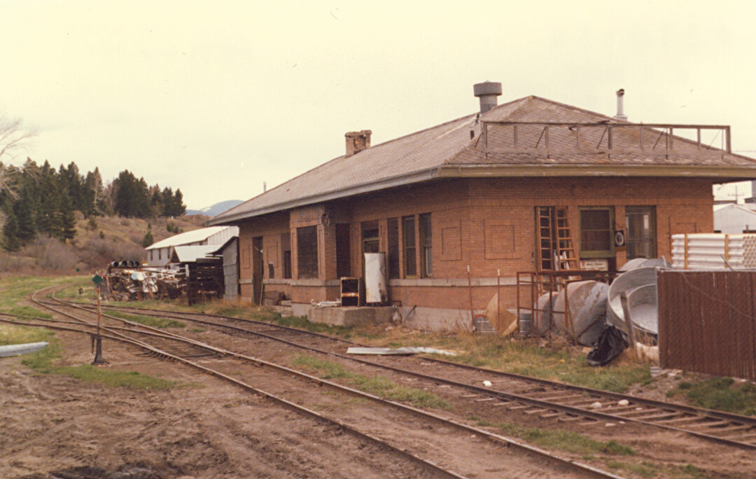
The Downtown Classic
Perfect for a summer morning or evening, this walk or run takes you past some of Bozeman’s beautiful historical treasures. Begin at Cooper Park, on the corner of 6th Avenue and Story Street. Travel east on Story Street, stopping to observe the beautiful Queen Anne-style mansion on the corner of Story and Grand Avenue. Many of the more distinguished buildings in early Bozeman were constructed from brick, which was much safer to use than wood. Brick also symbolized the town’s stability, in contrast with the hastily-constructed wooden buildings of most mining towns. When you reach the Bozeman Public Library parking lot, go south on the walking path, towards the Peet’s Hill trailhead. This path was originally the location of the Milwaukee Railroad’s passenger line, which connected Bozeman with the line’s main stop in Gallatin Gateway. As you ascend Peet’s Hill, you will pass Bozeman’s oldest and most popular sledding spot, where children in the 1870s, bundled in their winter coats and handmade mittens, would pass the winter weekends. As you look west across town, imagine Phyllis Smith’s description of early Bozeman: “As yet, no trees of any size grew in town. Cottonwoods and other saplings would soon be planted. Householders fenced their lots to keep wandering cattle and sheep from trampling their gardens. Family milk cows were tethered in backyards. On the front door of many homes hung a small decorative basket to hold calling cards from those stating their intention to pay a formal social visit.” Smith’s description reminds us of the expansive rural qualities of Bozeman in its early years. She describes sleighs taking children to school and making deliveries. For an extra few miles, descend the trails on the south end of Peet’s Hill, follow Kagy Boulevard back to Wilson Avenue, and travel north on Wilson while counting as many different architectural styles as you can find!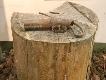
Brackett Creek
One of the oldest artifacts in the Gallatin History Museum is a rusted cap-and-ball pistol that was discovered next to Brackett Creek. The pistol dates back to 1864, the year that Jim Bridger led a wagon train north from the Oregon Trail on a route different than that of the Bozeman trail. In response to growing attacks on settlers travelling the Bozeman Trail (attacks due to violations of the 1851 Fort Laramie Treaty), Colonel William Collins requested that Jim Bridger lead a train of miners and settlers on a route west of the Bighorn Mountains, in order to avoid crossing into Sioux territory. Collins’ concerns were articulated in a telegraph to his commanders:
“Immigration is coming rapidly; trouble with the Indians may be expected, and I need power or instructions. … A large party is coming from Denver to go a new route from the Platte to the mines, crossing the Big Horn and Yellowstone. … Other trains are coming with same object. The route will be at least 200 miles shorter, through a country that ought to be opened, but a strong military party will be necessary. … I have devoted the last two years to understanding this country. … In this mountain service it is better to lead than follow immigration. Could I have my way, it should be sifted, controlled, and guided on designated routes; not permitted to run wild and make trouble.”
The “trouble” to which he refers were the violent incidents between the tribes that controlled the Powder River Basin and the wagon trains on the Bozeman Trail, which had military escorts. Jim Bridger’s trail avoided infringing on treaty-allocated lands, and ultimately led around twenty-five percent of Virginia City’s population safely to their destination. Although the two trails intersected at the Yellowstone River, near Livingston, they split again in their approach to the Gallatin Valley. Jim Bridger’s trail travelled further north and into the Bangtail Mountains, at present-day Brackett Creek. Next time you hike or run in this quiet, remote area, imagine hundreds of wagons, oxen, horses, supplies, and migrants travelling south through Bridger Canyon on their way to their new home.
Chestnut Mountain
On the first mile of this trail, which starts just east of the Trail Creek exit on Interstate 90, one can hear the train passing through the canyon. This sound is not an unfamiliar one in an area that once held multiple coal mines and their corresponding communities. Bozeman’s early residents were skeptical about the potential for successful coal mines east of town, but between 1882 and 1901, they were proven wrong. After the first coke oven was installed near Cokedale by William Henry Williams, mine construction spread throughout the area between Livingston and Bozeman. The output of the mines increased at a steady pace, which encouraged the Northern Pacific Railroad to purchase many of the sites. A spur railroad was constructed with access to loading sites, enabling the coal to travel to an expanded market.
What is most fascinating is the way in which these small communities developed autonomous resources and identities. The Chestnut Mine was located in roughly the same area as today’s trailhead, and around it flourished a small but determined town. Chestnut had four saloons, homes with electricity, boarding houses, a general store, a post office and a grocery. In the first few years of the 20th century, over 100 children began their education at the small school in Chestnut. The coal mining towns were a melting pot of immigrants from all over Europe and China. At the height of their prosperity, the coal mining towns are estimated to have held over one thousand residents. After 1910, the mines began to struggle. Both the railroad and homeowners turned to more efficient and less expensive types of fuel. Eventually, Chestnut and its nearby towns disappeared. This is a common story of boom and bust on the frontier, and anyone enjoying the lovely fall colors and solitude of Chestnut Mountain Trail can try to imagine a time when the area was full of the sounds of a mining town!
| Tweet |